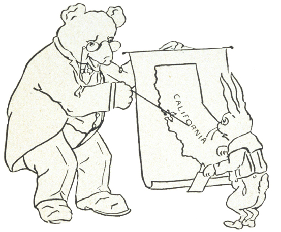

Field trips are fun to plan even if you never actually go there.
-
Decide where would you would like to visit.
-
Estimate how many miles it is from home.
-
Plan your route to get there and write the directions.
-
Research what makes this place historic.
-
Write a review of of your real or virtual field trip, like on Yelp or Trip Advisor, including what you’d see along the way.
-
Make a travel brochure or produce a video journal or PowerPoint of your California history field trip.
-
Post your review, brochure, video journal and PowerPoint on our Facebook page.

ALCATRAZ ISLAND
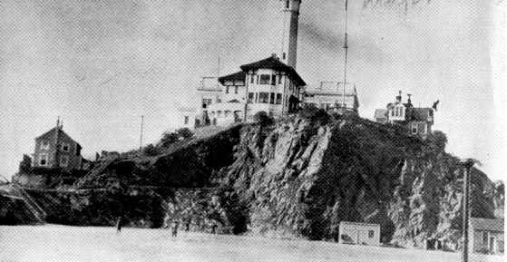
- “Frowning Alcatraz, Key of San Francisco” (1866)
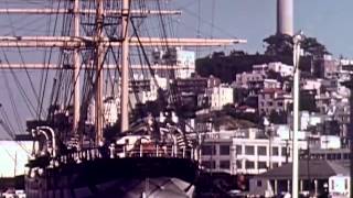
Alcatraz Island, in San Francisco Bay, offers a close-up look at the site of the first lighthouse and US built fort on the West Coast, the infamous federal penitentiary long off-limits to the public, and the 18 month occupation by Indians of All Tribes which saved the tribes.
Rich in history, there is also a natural side to the Rock—gardens, tide pools, bird colonies, and bay views beyond compare.
Today, the island’s facilities are managed by the National Park Service as part of the Golden Gate National Recreation Area; it is open to tours. Visitors can reach the island by ferry ride from Pier 33, near Fisherman’s Wharf.
Location: San Francisco Bay
ANGELS HOTEL
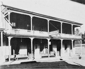
Angels Hotel
C.C. Lake erected a canvas hotel at Angels Camp in 1851.He replaced it with a one-story wooden structure then a stone building in 1855. Two years later he added a second story. This is where Samuel Clemens heard the yarn that he, as Mark Twain, brought to life in The Jumping Frog of Calaveras County.
Location: Angels Camp
BORONDA ADOBE
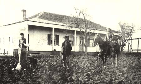
Boronda Adobe about 1887. Pictured are some of the family of William Anderson and Ines Boronda de Anderson, daughter of Eusebio. Courtesy of Monterey County Historical Society.
This was the home of José Eusebio Boronda, born into one of Alta California’s first families of settlers. Christened at Mission Santa Clara in 1808, he became a teacher and carpenter who helped build the San Francisco Mission and Presidio. In 1817 he built the first private home outside the walls of Monterey’s Royal Presidio. In 1839, wanting a rancho of his own, he settled his family on a 6,700 acre tract of land he called San José. Around 1846 he built this adobe home on a hill close to a lake which extended toward the northeast. The Mexican War broke out while Boronda was building his casa. He fought in the Battle of Natividad using his reata against Americans bringing horses to Fremont’s troops in Monterey.
Today the Monterey County Historical Society owns the Boronda Adobe and operates it as part of the Boronda History Center.
Video tour: http://www.youtube.com/watch?v=o5LVwYM1QUU
Location: Salinas.
CALIFORNIA CAVERN AT CAVE CITY
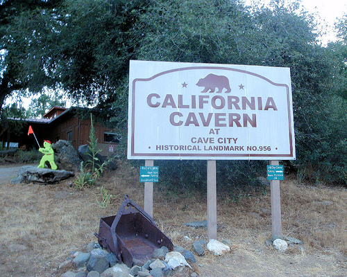
California Caverns at Cave City
The historical significance of California Cavern is well established as a major cavern system and one of the earliest officially recorded caves in the California Mother Lode.
Tourist activities took place as early as 1854.
Although one of numerous caves in the Mother Lode region, California Cavern claims the distinction of having the most extensive system of caverns and passageways.
Location: San Andreas
DOGTOWN NUGGET DISCOVERY SITE
California Historical Marker #771
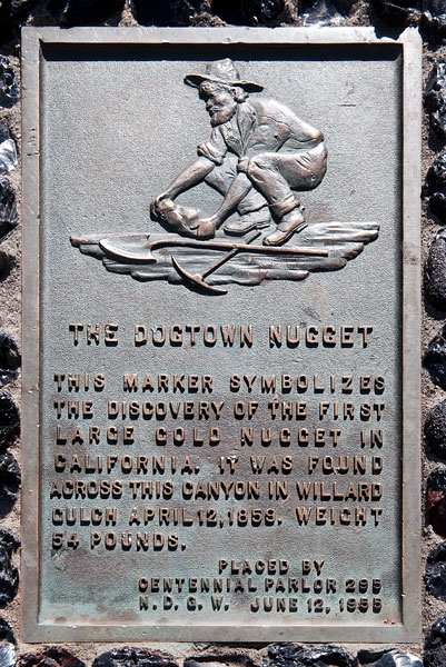
Dogtown Nugget plaque
The 54-pound Dogtown nugget was discovered April 12, 1859 at the Willard Claim, a hydraulic mine in the Feather River Canyon northeast of Magalia.
Dogtown was established as a gold mining camp shortly after the 1849 California gold rush on a ridge overlooking the West Branch of the Feather River Canyon.
One of the earliest known written accounts describing Dogtown was written after the journey of Robert Stuart and his two sons, Granville and James. Granville said,
“We spent a week at Sam Neal’s ranch in the Sacramento Valley, but as every meal we ate cost each of us one dollar, James and I determined to leave and go up into the mountains to the gold mines. We went sixteen miles up in the foothills to a little village on the ridge between the West Branch of the Feather River and Little Butte Creek. This little village was known as Butte Mills, because there was a sawmill nearby run by water power from Little Butte Creek, but it soon got its proper and well deserved name of Dogtown, for although there were only ten houses, there were sixteen fully developed dogs.”
Location: a ghost town in Mono County
EMERYVILLE SHELLMOUND
Emeryville’s Bay Street Shopping Center is a very busy place today. But for thousands of years there stood a group of 5 or 6 massive archaeological shell mounds. Some mounds were as tall as a 6 story building, 350 feet across.
They were where Ohlone people ate (the mounds are made mostly of shells), buried their dead and held ceremonies.
A large amusement park opened there in 1870, an industrial plant in the 1920s.
The shellmound is remembered at a park at the shopping center.
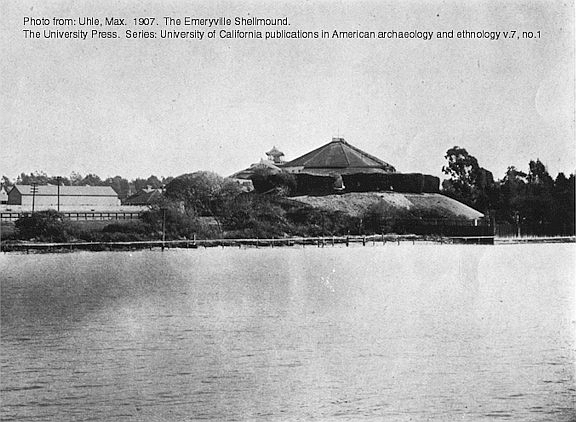
1902 photo, published 1907, of the Emeryville Shellmound with the historic shellmound park dance pavilion built on top. The shoreline of the San Francisco Bay reached to along the base of the shellmound at this time.
Location: Bay Street, Emeryville
FORT ROSS STATE HISTORIC PARK
This 3,400 acre park on the Sonoma Coast protects the natural landscapes, historic structures and exhibits. There you can feel what it was like living in the local Kashaya community, at the Imperial Russian settlement and during the early California Ranch era.
Rumor says some of the Fort Ross cannons had been captured from Napoleon’s retreat and later were later sold to John Sutter for protecting Sutter’s Fort.
Contact for living history events and other programs.
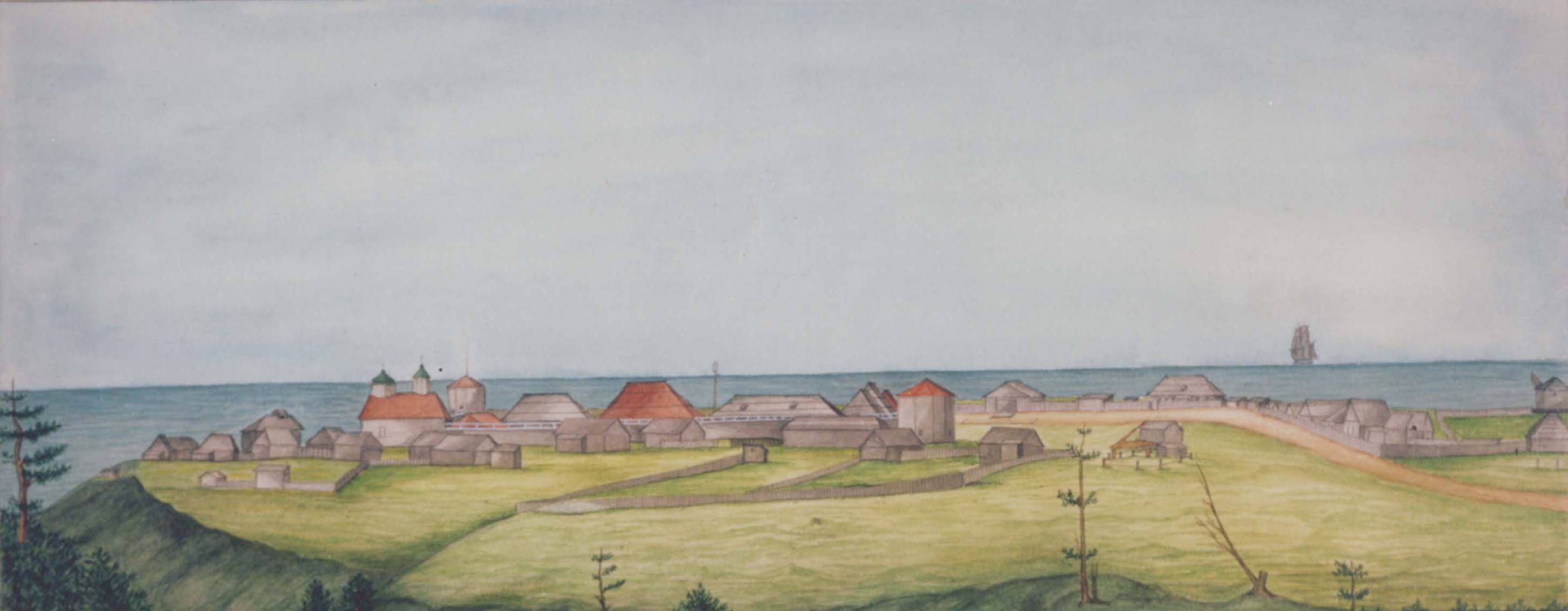
Watercolour of Fort Ross by I.G. Voznesenskii (1841)
Source: Peter the Great Museum of Anthropology and Ethnography, St.Petersburg.
Fort Ross State Historic Park virtual tour
GLENCOE, also known as MOSQUITO GULCH
California Historical Marker #280
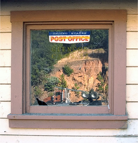
Glencoe, CA Post Office
Glencoe was also known as Mosquito Gulch. The business part of town was on the north side of Mosquito Gulch. None of the old buildings remains. The mines were first worked by the Mexicans in the early 1850s – quartz mining predominately but some placer mining.
The first post office was opened at Mosquito in 1858 but closed in 1869; it was re-established as Mosquito Gulch in 1873. The name was changed to Glencoe in 1912; the post office closed again in 1916, but was re-established in 1947
Location: on State Hwy 26 in Calaveras County
OAKLAND MUSEUM OF CALIFORNIA
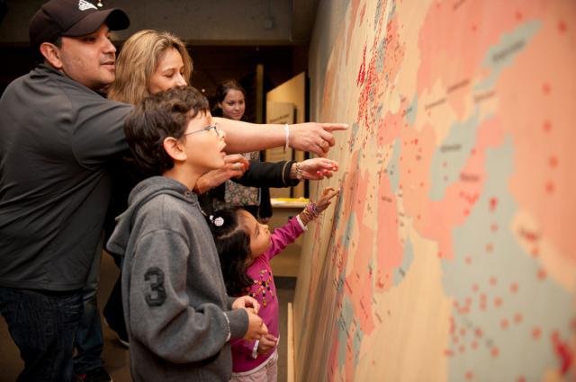
Oakland Museum of California
“History is made up of individual stories, and OMCA is a platform for bringing these stories to life—we are a place you can visit to explore these stories, and add your own.”—Louise Pubols, Senior Curator of History
ROUTE 66 “MOTHER ROAD” MUSEUM
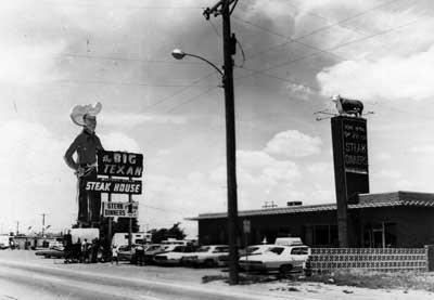
- Route 66 Big Texan Steak House
The Route 66 “Mother Road” Museum was dedicated on July 4, 2000 in the historic Casa del Desierto, Harvey House, in Barstow, California. The Museum displays a collection of historic photographs and artifacts related to Route 66 and the Mojave Desert Communities. Displays include development of the United States Route 66 from early pioneer trails, railroads, automotive history, businesses and sites.
“An eclectic mix of memorabilia, artifacts and history crammed into three or four rooms. Entry is free and you can happily while away an half an hour or so wandering around the museum and its well-stocked shop. The lady running it was chatty and had complementary soft drinks and biscuits on offer.” – Trip Advisor
Location: Barstow
TSURAI
The Yurok village, Tsurai, was located on the beach directly below Trinidad. It was there since prehistoric times. Captains Bodega noted its presence in 1775. The houses were made of hand-split redwood planks, designed for defense and protection. People lived in Tsurai until 1916.
Location: Corner of Ocean and Edwards Streets, Trinidad
VIRTUAL FIELD TRIP
California History and Tour from the Gold Rush to the 1940s